As is stated on the Expected Impacts: Regional page, it can be hard to visualize the impacts of a magnitude 9.0 Cascadia megathrust earthquake hitting the Pacific Northwest. What will it be like for families? For businesses? This page provides some estimates specific to Oregon that help conceptualize the aftermath of this eventual disaster.
“The fault is building up pressure and has the potential to produce a magnitude 8.0 to 9.0 earthquake with five to seven minutes of shaking and a tsunami.”
“About one million Oregon residents are expected to be displaced when the CSZ occurs.”
Curious what the shaking may be like in your home? What might fall down? What might move around? Check out this 3-D simulation where you can go inside this home and explore each room—and see hazards that exist if items aren’t properly secured.
Watch this movie. Seriously.
“The Oregon Coastal Hospital Resilience Project is a partnership among the Oregon Department of Geology and Mineral Industries (DOGAMI), Oregon Health Authority (OHA) Health Security, Preparedness and Response (HSPR), including the HSPR Healthcare Preparedness Program (HPP) regional liaisons, and the eleven hospitals along the Oregon coast. The goal of the project is to help hospitals better prepare for a magnitude 9 Cascadia subduction zone earthquake and tsunami.“
A note about this publication: several of these schools have been seismically retrofitted since this report was published. Reach out to a specific school or the school district to find out whether a retrofit has been completed or is planned.
A note about this document: if you have children in school, ask that school what the plan is for the kids after the shaking. They’ll evacuate the school… but what about after? Will the kids stay in the school’s field? Is there a backup plan if it’s freezing outside? Pouring rain? It can take some parents more than 12 hours to reach their children in a reunification scenario if they work on the other side of a river and the bridge goes down, for example. And many teachers will have their own children to pick up from other schools. Ask the hard questions.
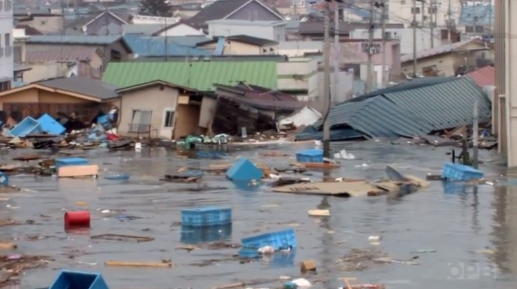
“In their current state, our buildings and lifelines (transportation, energy, telecommunications, and water/wastewater systems) would be damaged so severely that it would take three months to a year to restore full service in the western valleys, more than a year in the hardest-hit coastal areas, and many years in the coastal communities inundated by the tsunami. Experience from past disasters has shown that businesses will move or fail if services cannot be restored in one month; so Oregon faces a very real threat of permanent population loss and long-term economic decline.”
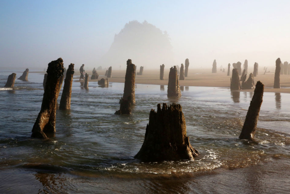
“A nearby earthquake could drop the low-lying regions of the coast several feet below sea level. The highest tsunami waves could reach 80 feet and severely flood coastal communities near beaches, bay mouths, and low-elevation coastal plains. Oregon’s at-risk population is approximately 40,000 on the outer coast, excluding tourists and visitors that seasonally swell the population manyfold.”
“New tsunami simulations indicate that the largest waves may run up to elevations twice as high as earlier models predicted, and flooding may inundate hundreds of yards farther up coastal valleys.”
According to the Oregon Seismic and Safety Policy Advisory Council (OSSPAC), “A full 9.0 megathrust Cascadia earthquake and resulting tsunami will create an unprecedented magnitude of emergency need… Reaching impacted populations, many of whom will be isolated, will present a level of operational complexity our state and country have never seen before… We currently have low resilience and low capacity to provide for the enormous emergency response that will be needed to support those most highly-impacted by a Cascadia event… We are not prepared if a Cascadia event happens in the near future.”
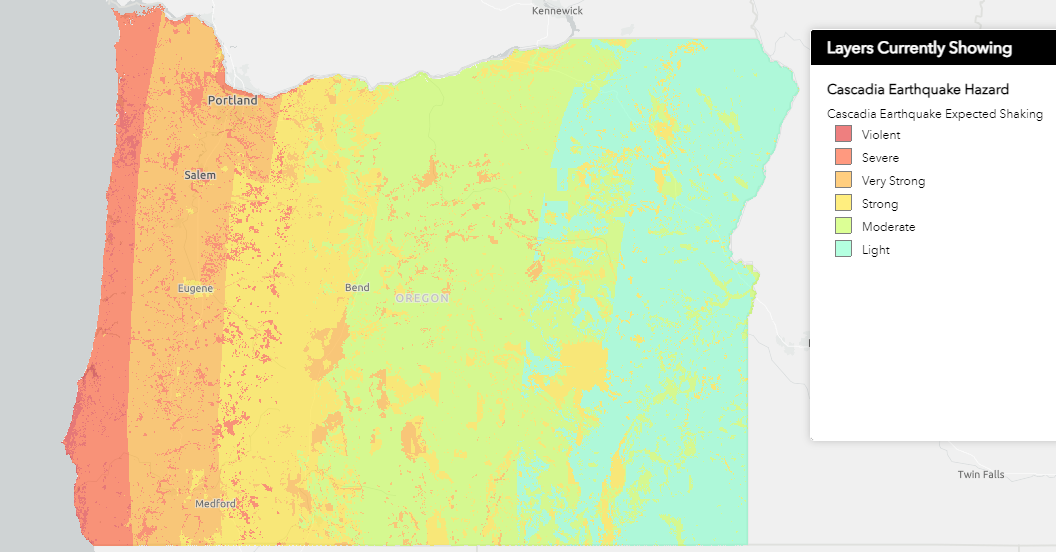
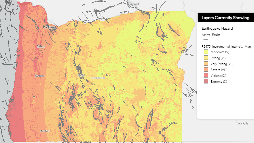
This system allows users to view landslide and liquefaction risks, expected shaking intensities, active faults and more. You can zoom in much more than the images below allow.
Check out OSU’s O-Help page to generate address-specific reports like the one shown here. Run it for your home, place of business, child’s school, etc. (Click section header for hyperlink)
DOGAMI offers maps for Landslide Susceptibility, Liquefaction Susceptibility, Peak Ground Acceleration, Peak Ground Velocity, Co-seismic Subsidence, Permanent Ground Deformation, and many more in an Open-File Report Series. Each map can be viewed and downloaded, and allows the user to zoom in for finer details.
Have you ever wondered what impact the earthquake will have on Central Oregon? It can be hard to imagine a fault 50 miles offshore that runs nearly parallel to the coastline, causing shaking in Bend, Oregon. That’s the power of a Cascadia megathrust earthquake. Central Oregon Daily News produced this two-part series highlighting the expected impacts for cities and the region’s role in the aftermath. Food, fuel, and other supplies availability will be impacted, and the second video offers suggestions for getting prepared.
Oregon State University Professor Emeritus Chris Goldfinger is interviewed in the first video. According to Professor Goldfinger, Central Oregon residents will feel the shaking. It will be more gentle than what communities in the West experience. He describes it as:
“feeling long rolling like you are on a boat dock… Even small accelerations, when applied to unreinforced masonry-type buildings, may be enough to do significant damage, and it’s really going to be a case-by-case basis.”
